Файл:Map Presenting the Discoveries of Russian Navigators in the Pacific Ocean, as Well as Those of Captain Cook WDL127.png

Исходный файл (1471 × 1024 пкс, размер файла: 1,55 Мб, MIME-тип: image/png)
Описание
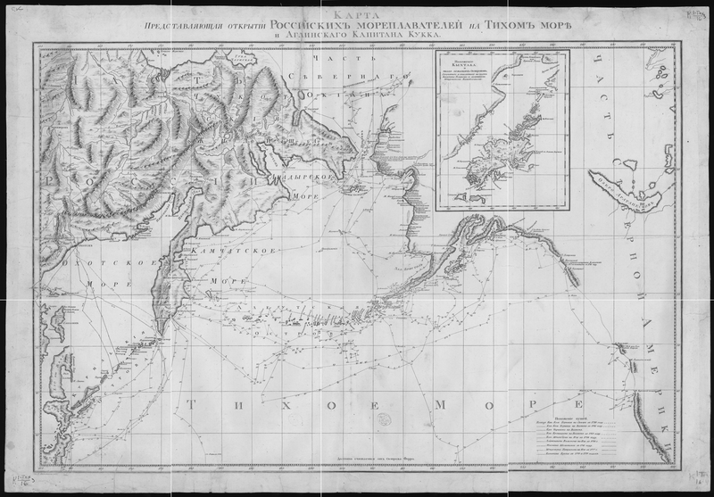
| Описание | This 1787 map shows the voyages of the leading Russian explorers of the North Pacific: Bering, Chirikov, Krenitsyn, Shpanberg, Walton, Shel'ting, and Petushkov. It also shows the 1778-79 voyage of British Captain James Cook. The route of each voyage is depicted in great detail, with ship locations plotted by the day. Other details on the map include administrative borders, population centers, Chukchi dwellings, and impassable ice. The inset map is of Kodiak Island, Alaska, denoted here by its Russian name of Kykhtak.
|
|---|---|
| Источник |
|
| Время создания | 1787 |
| Автор или правообладатель | Wilbrecht, Alexander — Лицензия: Public domain (в общественном достоянии) |
| Другие версии файла | — |
Источник файла — сайт Wikimedia Commons, куда он был загружен под одной из свободных лицензий ( https://commons.wikimedia.org/wiki/File:Map_Presenting_the_Discoveries_of_Russian_Navigators_in_the_Pacific_Ocean,_as_Well_as_Those_of_Captain_Cook_WDL127.png ). Авторов, работавших над этим файлом см. в истории файла: https://commons.wikimedia.org/w/index.php?title=File:Map_Presenting_the_Discoveries_of_Russian_Navigators_in_the_Pacific_Ocean,_as_Well_as_Those_of_Captain_Cook_WDL127.png&action=history
В общем случае в статьях энциклопедии Руниверсалис файлы используются в соответствии со статьёй 1274 Гражданского кодекса Российской Федерации.
История файла
Нажмите на дату/время, чтобы увидеть версию файла от того времени.
| Дата/время | Миниатюра | Размеры | Участник | Примечание | |
|---|---|---|---|---|---|
| текущий | 21:07, 5 августа 2023 | | 1471 × 1024 (1,55 Мб) | I, Robot (обсуждение | вклад) | == Описание == {{Изображение | описание = This 1787 map shows the voyages of the leading Russian explorers of the North Pacific: Bering, Chirikov, Krenitsyn, Shpanberg, Walton, Shel'ting, and Petushkov. It also shows the 1778-79 voyage of British Captain James Cook. The route of each voyage is depicted in great detail, with ship locations plotted by the day. Other details on the map include administrative borders, population centers, Chukchi dwellings, and impassable ice. The inset map is of... |
Вы не можете перезаписать этот файл.
Использование файла
Следующий файл является дубликатом этого файла (подробности):
Следующая страница использует этот файл: