
Файл:Strait of Gibraltar perspective.jpg

Исходный файл (1528 × 917 пкс, размер файла: 182 КБ, MIME-тип: image/jpeg)
Описание
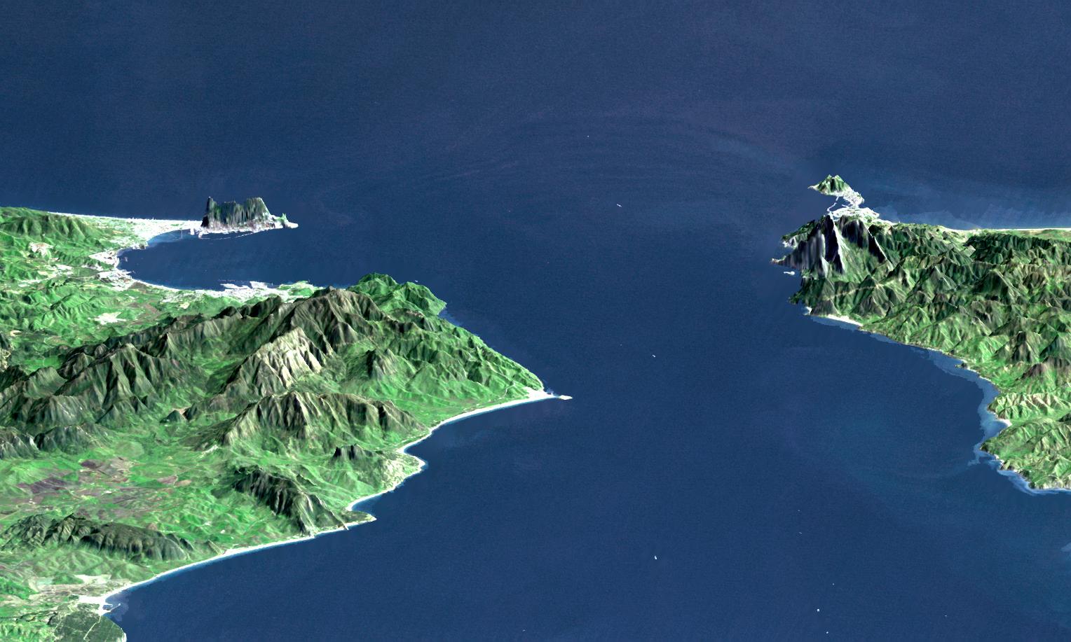
| Описание | "This perspective view shows the Strait of Gibraltar, which is the entrance to the Mediterranean Sea from the Atlantic Ocean, with a 3-times vertical exaggeration to enhance topographic expression. Europe (Spain) is on the left. Africa (Morocco) is on the right. The Rock of Gibraltar, administered by Great Britain, is the peninsula in the back left." (quotation taken from the more detailed NASA description page)
|
|---|---|
| Источник | http://photojournal.jpl.nasa.gov/catalog/PIA03397 |
| Время создания |
|
| Автор или правообладатель | NASA / JPL / NIMA — Лицензия: Public domain (в общественном достоянии) |
| Другие версии файла | — |
Источник файла — сайт Wikimedia Commons, куда он был загружен под одной из свободных лицензий ( https://commons.wikimedia.org/wiki/File:Strait_of_Gibraltar_perspective.jpg ). Авторов, работавших над этим файлом см. в истории файла: https://commons.wikimedia.org/w/index.php?title=File:Strait_of_Gibraltar_perspective.jpg&action=history
В общем случае в статьях энциклопедии Руниверсалис файлы используются в соответствии со статьёй 1274 Гражданского кодекса Российской Федерации.
История файла
Нажмите на дату/время, чтобы увидеть версию файла от того времени.
| Дата/время | Миниатюра | Размеры | Участник | Примечание | |
|---|---|---|---|---|---|
| текущий | 08:36, 15 января 2024 | | 1528 × 917 (182 КБ) | Я, робот (обсуждение | вклад) | == Описание == {{Изображение | описание = "This perspective view shows the Strait of Gibraltar, which is the entrance to the Mediterranean Sea from the Atlantic Ocean, with a 3-times vertical exaggeration to enhance topographic expression. Europe (Spain) is on the left. Africa (Morocco) is on the right. The Rock of Gibraltar, administered by Great Britain, is the peninsula in the back left." (quotation taken from the more detailed NASA description page) <ul><li>View Size: 46 kilometers (28 m... |
Вы не можете перезаписать этот файл.
Использование файла
Следующий файл является дубликатом этого файла (подробности):
- Файл:Strait of Gibraltar perspective.jpg из на Викискладе
Следующие 2 страницы используют этот файл: