
Файл:Lake mweru.jpg
Размер этого предпросмотра: 600 × 600 пкс. Другие разрешения: 2048 × 2048 пкс | 4209 × 4209 пкс.
Исходный файл (4209 × 4209 пкс, размер файла: 313 КБ, MIME-тип: image/jpeg)
Описание
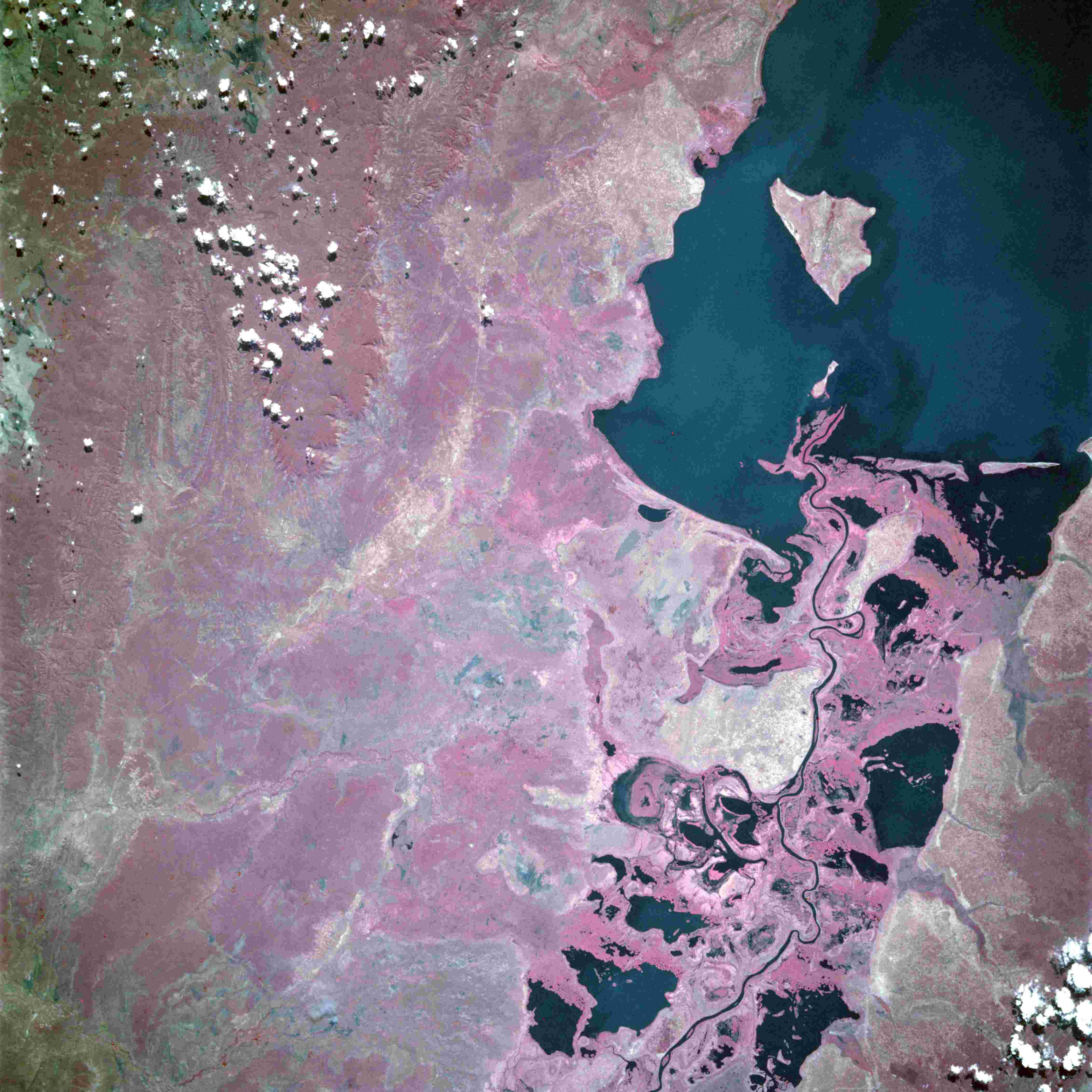
| Описание | Lake Mweru, Democratic Republic of the Congo and Zambia - June 1993
|
|---|---|
| Источник | https://eol.jsc.nasa.gov/SearchPhotos/photo.pl?mission=STS057&roll=104&frame=63 |
| Время создания | Taken on 28 June 1993, 10:31:23 |
| Автор или правообладатель | NASA — Лицензия: Public domain (в общественном достоянии) |
| Другие версии файла | — |
Источник файла — сайт Wikimedia Commons, куда он был загружен под одной из свободных лицензий ( https://commons.wikimedia.org/wiki/File:Lake_mweru.jpg ). Авторов, работавших над этим файлом см. в истории файла: https://commons.wikimedia.org/w/index.php?title=File:Lake_mweru.jpg&action=history
В общем случае в статьях энциклопедии Руниверсалис файлы используются в соответствии со статьёй 1274 Гражданского кодекса Российской Федерации.
История файла
Нажмите на дату/время, чтобы увидеть версию файла от того времени.
| Дата/время | Миниатюра | Размеры | Участник | Примечание | |
|---|---|---|---|---|---|
| текущий | 14:52, 3 ноября 2023 | | 4209 × 4209 (313 КБ) | Я, робот (обсуждение | вклад) | == Описание == {{Изображение | описание = Lake Mweru, Democratic Republic of the Congo and Zambia - June 1993 <ul><li>The southern end of Lake Mweru, a large freshwater lake with a maximum depth of at least 80 feet (25 meters), is visible in this near-vertical, color infrared photograph. The lake forms part of the border between Zaire to the west and Zambia to the east. The lake, noted for its large fisheries, is part of the Bangweulu wetland system and the Luapula River, which flows northwa... |
Вы не можете перезаписать этот файл.
Использование файла
Следующая страница использует этот файл: