Файл:Canton1860.jpg

Размер этого предпросмотра: 800 × 457 пкс. Другие разрешения: 2560 × 1462 пкс | 9344 × 5337 пкс.
Исходный файл (9344 × 5337 пкс, размер файла: 961 Кб, MIME-тип: image/jpeg)
Описание
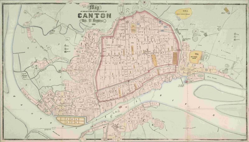
| Описание | "Map of the City and Entire Suburbs of Canton in 1860 by Rev. D. Vrooman", an updating of Vrooman's 1855 map of the city, incorporating the destruction of the Thirteen Factories, the erection of Shamian, and minor adjustments to his prospective map of the city following its opening to foreign visitors following the treaties of Tianjin and Beijing. |
|---|---|
| Источник | http://www.nla.gov.au/apps/cdview/nla.map-lms636 |
| Время создания | 1860 |
| Автор или правообладатель | Daniel Vrooman
— Лицензия: Public domain (в общественном достоянии) |
| Другие версии файла | — |
Источник файла — сайт Wikimedia Commons, куда он был загружен под одной из свободных лицензий ( https://commons.wikimedia.org/wiki/File:Canton1860.jpg ). Авторов, работавших над этим файлом см. в истории файла: https://commons.wikimedia.org/w/index.php?title=File:Canton1860.jpg&action=history
В общем случае в статьях энциклопедии Руниверсалис файлы используются в соответствии со статьёй 1274 Гражданского кодекса Российской Федерации.
История файла
Нажмите на дату/время, чтобы увидеть версию файла от того времени.
| Дата/время | Миниатюра | Размеры | Участник | Примечание | |
|---|---|---|---|---|---|
| текущий | 01:17, 25 сентября 2023 | | 9344 × 5337 (961 Кб) | Я, робот (обсуждение | вклад) | == Описание == {{Изображение | описание = "Map of the City and Entire Suburbs of Canton in 1860 by Rev. D. Vrooman", an updating of Vrooman's 1855 map of the city, incorporating the destruction of the [https://en.wikipedia.org/wiki/Thirteen_Factories Thirteen Factories], the erection of [https://en.wikipedia.org/wiki/Shamian_Island Shamian], and minor adjustments to his prospective map of the city following its opening to foreign visitors following the treaties of [https://en.wikipedia.org/w... |
Вы не можете перезаписать этот файл.
Использование файла
Следующая страница использует этот файл: