
Файл:1947-UN-Partition-Plan-1949-Armistice-Comparison.svg

Исходный файл (SVG-файл, номинально 367 × 1029 пкс, размер файла: 48 КБ)
Описание
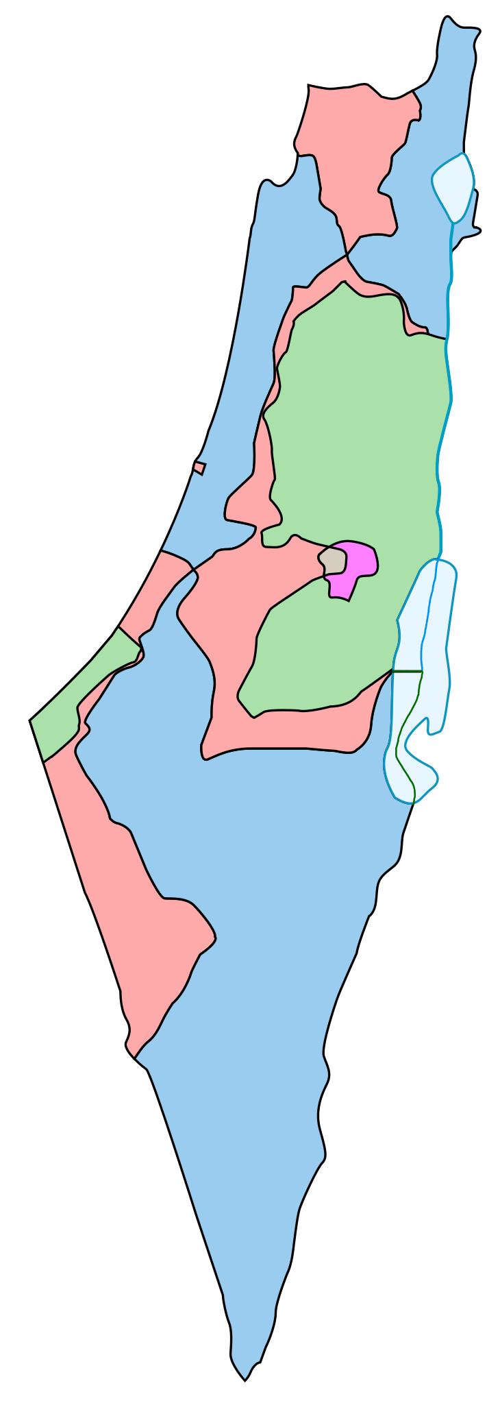
| Описание | Comparison between the boundaries in the November 29th 1947 United Nations General Assembly partition plan (Resolution 181) for the British Mandate Territory of Palestine and the eventual armistice boundaries of 1949-1950. The meaning of the map colors is as follows (a legend caption is available in template form here):
Some limitations of the map:
|
|---|---|
| Источник | This is a partial SVG conversion (omitting text) of the original PostScript vector source of raster Image:1947-UN-Partition-Plan-1949-Armistice-Comparison.png by User:AnonMoos. Apparently, http://unispal.un.org/UNISPAL.NSF/0/651C804E6815FB28852575DF004B7C4C, ANNEX II, is the ultimate (UN) source. |
| Время создания | 2007-07-13 |
| Автор или правообладатель | AnonMoos — Лицензия: Public domain (в общественном достоянии) |
| Другие версии файла | — |
Источник файла — сайт Wikimedia Commons, куда он был загружен под одной из свободных лицензий ( https://commons.wikimedia.org/wiki/File:1947-UN-Partition-Plan-1949-Armistice-Comparison.svg ). Авторов, работавших над этим файлом см. в истории файла: https://commons.wikimedia.org/w/index.php?title=File:1947-UN-Partition-Plan-1949-Armistice-Comparison.svg&action=history
В общем случае в статьях энциклопедии Руниверсалис файлы используются в соответствии со статьёй 1274 Гражданского кодекса Российской Федерации.
История файла
Нажмите на дату/время, чтобы увидеть версию файла от того времени.
| Дата/время | Миниатюра | Размеры | Участник | Примечание | |
|---|---|---|---|---|---|
| текущий | 11:50, 9 августа 2023 | 367 × 1029 (48 КБ) | Я, робот (обсуждение | вклад) | == Описание == {{Изображение | описание = Comparison between the boundaries in the November 29th 1947 United Nations General Assembly partition plan ([https://en.wikipedia.org/wiki/1947_UN_Partition_Plan Resolution 181]) for the [https://en.wikipedia.org/wiki/British_Mandate_of_Palestine British Mandate Territory of Palestine] and the eventual [https://en.wikipedia.org/wiki/1949_Armistice_Agreements armistice boundaries of 1949-1950]. The meaning of the map colors is as follows (a legend cap... |
Вы не можете перезаписать этот файл.
Использование файла
Следующий файл является дубликатом этого файла (подробности):
- Файл:1947-UN-Partition-Plan-1949-Armistice-Comparison.svg из на Викискладе
Следующие 2 страницы используют этот файл: