


Файл:Qaidam-basin-china.jpg

Исходный файл (1280 × 1280 пкс, размер файла: 1,16 МБ, MIME-тип: image/jpeg)
Описание
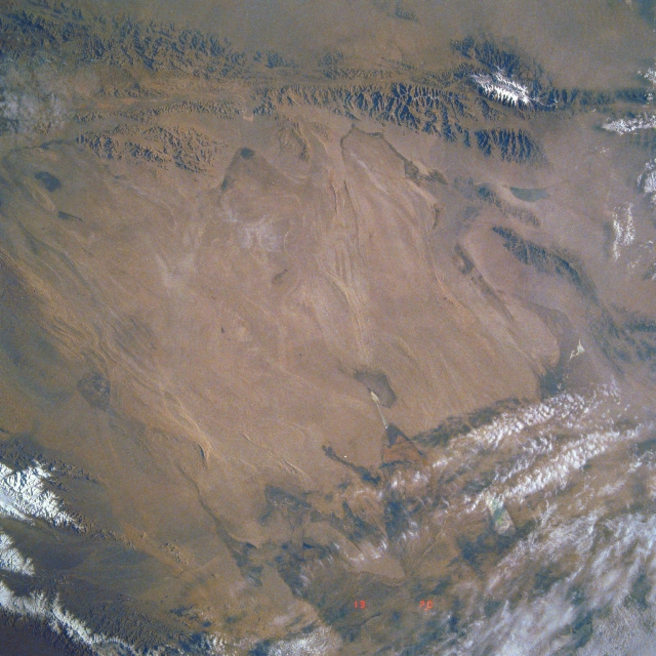
| Описание | Image Caption: STS040-613-011 Qaidam Basin, China June 1991 This mostly east-looking view [here rotated to place north at the top] shows the Qaidam Basin. Located in the Northern Tibetan Plateau, the Qaidam Basin sets between two branches of the Kunlun Mountains. To the north (left edge) are the Altun Mountains and to the south (right edge) are the Qimantag Mountains. The arid basin is 350 miles (560 km) long and 100 miles (160 km) wide. A salt marsh occupies most of the basin. Oil fields and refineries are located in the west part (bottom center) of the basin. Iron ore is mined in the southern part of the basin. Coal deposits have been found in the Qaidam Basin. Cooler climate crops such as wheat, highland barley, millet, and potatoes are grown during the short, cool summer months. |
|---|---|
| Источник | https://eol.jsc.nasa.gov/SearchPhotos/photo.pl?mission=STS040&roll=613&frame=11
|
| Время создания | 1991-06 |
| Автор или правообладатель | NASA — Лицензия: Public domain (в общественном достоянии) |
| Другие версии файла | — |
Источник файла — сайт Wikimedia Commons, куда он был загружен под одной из свободных лицензий ( https://commons.wikimedia.org/wiki/File:Qaidam-basin-china.jpg ). Авторов, работавших над этим файлом см. в истории файла: https://commons.wikimedia.org/w/index.php?title=File:Qaidam-basin-china.jpg&action=history


В общем случае в статьях энциклопедии Руниверсалис файлы используются в соответствии со статьёй 1274 Гражданского кодекса Российской Федерации.
История файла
Нажмите на дату/время, чтобы увидеть версию файла от того времени.
| Дата/время | Миниатюра | Размеры | Участник | Примечание | |
|---|---|---|---|---|---|
| текущий | 01:43, 24 ноября 2023 | | 1280 × 1280 (1,16 МБ) | Я, робот (обсуждение | вклад) | == Описание == {{Изображение | описание = Image Caption: STS040-613-011 Qaidam Basin, China June 1991<br/><br/> This mostly east-looking view [<i>here rotated to place north at the top</i>] shows the Qaidam Basin. Located in the Northern Tibetan Plateau, the Qaidam Basin sets between two branches of the Kunlun Mountains. To the north (left edge) are the Altun Mountains and to the south (right edge) are the Qimantag Mountains. The arid basin is 350 miles (560 km) long and 100 miles (160 km) w... |
Вы не можете перезаписать этот файл.
Использование файла
Следующий файл является дубликатом этого файла (подробности):

- Файл:Qaidam-basin-china.jpg на общем хранилище
Следующая страница использует этот файл:
