


Файл:PIA03555 - Menrva, dunes, channels.png

Исходный файл (1591 × 1124 пкс, размер файла: 1,39 МБ, MIME-тип: image/png)
Описание
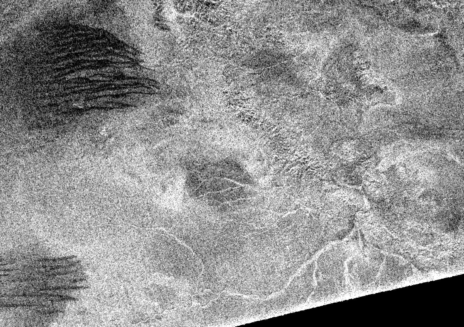
| Описание | Area to southeast from crater Menrva on Titan. North is up, image width is about 270 km. Crater's rim is seen in upper right part of the image. Dark strips are dunes, and bright river channels were made by liquid methane (but now they are dry). The biggest river system comes into the crater via it's rim; some smaller channels can be seen inside the crater.
Description from NASA Photojournal: Synthetic aperture radar images obtained in February 2005 show that Titan's surface is modified by fluid flows and wind-driven deposits. Previous synthetic aperture radar images have shown features that may be cryovolcanic in origin, such as long flows (see PIA06993) and linear features that may have formed by tectonic processes (see PIA06995). The latest data argue that Titan has a young and dynamic surface that is modified by all four major geologic processes: volcanism, tectonism, erosion, and impact cratering. All surfaces of solid bodies are shaped by these four processes, and Cassini-Huygens is revealing how each has contributed to the Titan we see today. The data show a variety of surface drainage patterns that include twisting channels 1 to 2 kilometers-wide (0.6 to 1.2 miles) and up to 200-kilometers-long (124 miles). There is a well-developed drainage pattern associated with a large (450-kilometer, or 280 mile-diameter) basin that has eroded part of the basin's rim on the lower right of the image. These patters are in much larger scales than those imaged by the Huygens probe. The most surprising new features revealed in the synthetic aperture images are dark lineated streaks, dubbed "cat scratches," which are seen in patches throughout the whole radar swath image (see PIA07009). The "scratches" are interpreted as linear/longitudinal dunes formed by wind transport. Radar images of terrestrial dunes, such as snow dunes in Antarctica, show remarkably similar patterns. Individual "scratches" are 500 meters to 1 kilometer (1,640 feet to 0.6 miles) across and spaced by 1 to 2 kilometer intervals (0.6 to 1.2-mile), straight or undulated, and oriented roughly east-west, suggesting a direction of prevalent winds. |
|---|---|
| Источник | http://photojournal.jpl.nasa.gov/catalog/PIA03555 (brightness of original image was increased) |
| Время создания | 2005-02-15 |
| Автор или правообладатель | NASA — Лицензия: Public domain (в общественном достоянии) |
| Другие версии файла | — |
Источник файла — сайт Wikimedia Commons, куда он был загружен под одной из свободных лицензий ( https://commons.wikimedia.org/wiki/File:PIA03555_-_Menrva,_dunes,_channels.png ). Авторов, работавших над этим файлом см. в истории файла: https://commons.wikimedia.org/w/index.php?title=File:PIA03555_-_Menrva,_dunes,_channels.png&action=history


В общем случае в статьях энциклопедии Руниверсалис файлы используются в соответствии со статьёй 1274 Гражданского кодекса Российской Федерации.
История файла
Нажмите на дату/время, чтобы увидеть версию файла от того времени.
| Дата/время | Миниатюра | Размеры | Участник | Примечание | |
|---|---|---|---|---|---|
| текущий | 20:08, 15 декабря 2023 | | 1591 × 1124 (1,39 МБ) | I, Robot (обсуждение | вклад) | == Описание == {{Изображение | описание = Area to southeast from crater [https://en.wikipedia.org/wiki/Menrva_(crater) Menrva] on Titan. North is up, image width is about 270 km. Crater's rim is seen in upper right part of the image. Dark strips are dunes, and bright river channels were made by liquid methane (but now they are dry). The biggest river system comes into the crater via it's rim; some smaller channels can be seen inside the crater. <p>Description from NASA Photojournal: Syntheti... |
Вы не можете перезаписать этот файл.
Использование файла
Следующий файл является дубликатом этого файла (подробности):

- Файл:PIA03555 - Menrva, dunes, channels.png на общем хранилище
Следующая страница использует этот файл:
