


Файл:Ngorongoro topo.jpg

Исходный файл (1061 × 1061 пкс, размер файла: 471 КБ, MIME-тип: image/jpeg)
Описание
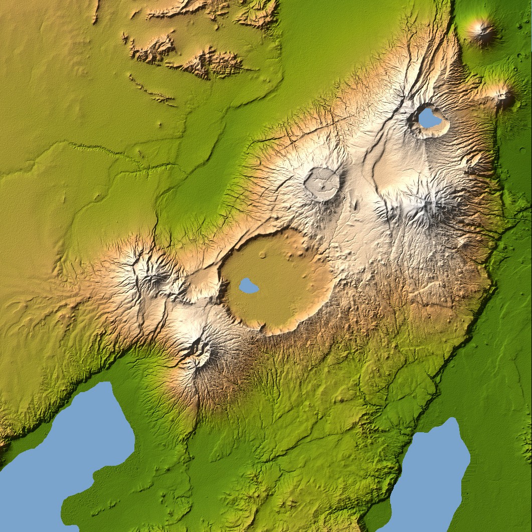
| Описание | Ngorongoro’s caldera is 22.5 kilometers (14 miles) across at its widest point and is 610 meters (2,000 feet) deep. Its floor is very level, holding a lake fed by streams running down the caldera wall. It is part of the Ngorongoro Conservation Area and is home to over 75,000 animals. The lakes south of the crater are Lake Eyasi and Lake Manyara, also part of the conservation area. Orientation: North toward the top, Mercator projection Image Data: shaded and colored SRTM elevation model. The shade image was derived by computing topographic slope in the northwest-southeast direction, so that northwest slopes appear bright and southeast slopes appear dark. Color coding is directly related to topographic height, with green at the lower elevations, rising through yellow and tan, to white at the highest elevations. Date Acquired: February 2000 |
|---|---|
| Источник | NASA Earth Observatory, Topography of Olduvai Gorge, East Africa (Outcut) |
| Время создания | 2000-02 |
| Автор или правообладатель | NASA — Лицензия: Public domain (в общественном достоянии) |
| Другие версии файла | — |
Источник файла — сайт Wikimedia Commons, куда он был загружен под одной из свободных лицензий ( https://commons.wikimedia.org/wiki/File:Ngorongoro_topo.jpg ). Авторов, работавших над этим файлом см. в истории файла: https://commons.wikimedia.org/w/index.php?title=File:Ngorongoro_topo.jpg&action=history


В общем случае в статьях энциклопедии Руниверсалис файлы используются в соответствии со статьёй 1274 Гражданского кодекса Российской Федерации.
История файла
Нажмите на дату/время, чтобы увидеть версию файла от того времени.
| Дата/время | Миниатюра | Размеры | Участник | Примечание | |
|---|---|---|---|---|---|
| текущий | 17:55, 22 ноября 2023 | | 1061 × 1061 (471 КБ) | I, Robot (обсуждение | вклад) | == Описание == {{Изображение | описание = <p>Ngorongoro’s caldera is 22.5 kilometers (14 miles) across at its widest point and is 610 meters (2,000 feet) deep. Its floor is very level, holding a lake fed by streams running down the caldera wall. It is part of the Ngorongoro Conservation Area and is home to over 75,000 animals. The lakes south of the crater are Lake Eyasi and Lake Manyara, also part of the conservation area. </p><p><b>Orientation:</b> North toward the top, Mercator projection... |
Вы не можете перезаписать этот файл.
Использование файла
Следующий файл является дубликатом этого файла (подробности):

- Файл:Ngorongoro topo.jpg на общем хранилище
Следующая страница использует этот файл:
