


Файл:Kaloum Peninsula 2000.jpg
Размер этого предпросмотра: 800 × 600 пкс. Другое разрешение: 1600 × 1200 пкс.

Исходный файл (1600 × 1200 пкс, размер файла: 94 КБ, MIME-тип: image/jpeg)
Описание
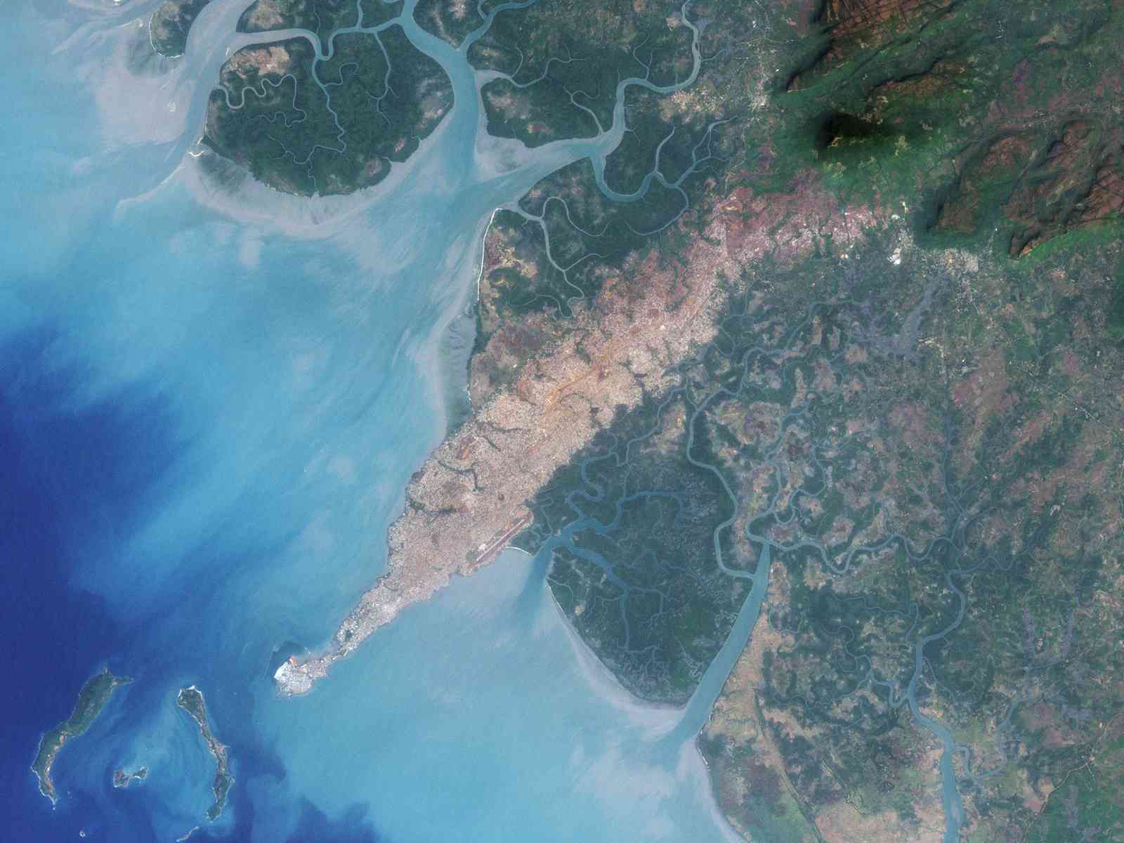
| Описание | The city of Conakry, Guinea, originated on Tombo Island and spread up the Kaloum Peninsula, sandwiched between mangrove swamps. In the 1960s, the city had a population of fewer than 40,000; in 2006, it had a population of nearly 2 million. These natural-color images, acquired by NASA’s Landsat satellites, show the city’s dramatic growth from 1986 to 2000. Land and water features look similar to how they would look in a photograph by a digital camera. Water ranges in color from deep to pale blue, vegetation appears dark green, and bare ground and urbanized areas range in color from gray to beige to reddish-brown. |
|---|---|
| Источник | Earth Observatory |
| Время создания | 2000-12-19 |
| Автор или правообладатель | NASA image created by Jesse Allen, using Landsat data provided by the United States Geological Survey. Landsat 7 — Лицензия: Public domain (в общественном достоянии) |
| Другие версии файла | — |
Источник файла — сайт Wikimedia Commons, куда он был загружен под одной из свободных лицензий ( https://commons.wikimedia.org/wiki/File:Kaloum_Peninsula_2000.jpg ). Авторов, работавших над этим файлом см. в истории файла: https://commons.wikimedia.org/w/index.php?title=File:Kaloum_Peninsula_2000.jpg&action=history


В общем случае в статьях энциклопедии Руниверсалис файлы используются в соответствии со статьёй 1274 Гражданского кодекса Российской Федерации.
История файла
Нажмите на дату/время, чтобы увидеть версию файла от того времени.
| Дата/время | Миниатюра | Размеры | Участник | Примечание | |
|---|---|---|---|---|---|
| текущий | 21:01, 17 октября 2023 | | 1600 × 1200 (94 КБ) | I, Robot (обсуждение | вклад) | == Описание == {{Изображение | описание = The city of Conakry, Guinea, originated on Tombo Island and spread up the Kaloum Peninsula, sandwiched between mangrove swamps. In the 1960s, the city had a population of fewer than 40,000; in 2006, it had a population of nearly 2 million. These natural-color images, acquired by NASA’s Landsat satellites, show the city’s dramatic growth from 1986 to 2000. Land and water features look similar to how they would look in a photograph by a digital camera.... |
Вы не можете перезаписать этот файл.
Использование файла
Следующая страница использует этот файл:
