


Файл:Falkland Islands topographic map-ru.svg
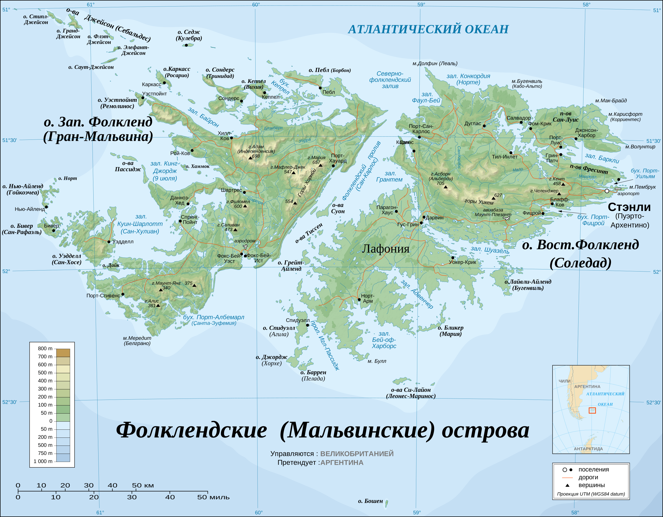


Исходный файл (SVG-файл, номинально 2550 × 1990 пкс, размер файла: 1,94 МБ)
Описание
| Описание | The Falkland Islands are an archipelago in the South Atlantic Ocean, located 300 miles off the coast of Argentina. They consist of two main islands, East Falkland and West Falkland, together with about 700 smaller islands. Stanley, on East Falkland, is the capital and largest city. The islands are a self-governing Overseas Territory of the United Kingdom. |
|---|---|
| Источник | Own work ; Topographic map : NASA Shuttle Radar Topography Mission (SRTM3 v.2) (public domain) edited with dlgv32 Pro/Global Mapper and vectorized with Inkscape ; UTM projection ; WGS84 datum ; shaded relief (composite image of N-W, W and N lightning positions) ; Approximate scale of topographic data and shore / lakes limits : 1:705,000 ; of the bathymetry : 1:3.720.000 Bathymetry : USGov public domain data provided by the Demis add-on for World Wind (see the approval e-mail) ; Other references used for additional data : * UK government map ; * NASA World Wind ; * CIA map available on the site of the University of Texas at Austin ; * Microsoft Encarta atlas (1999 edition). Note : The shaded relief is a raster image embedded in the SVG file which increases its size. If you want a lighter map for other purposes, delete the shaded relief image in your file. |
| Время создания | 2010-04-21 |
| Автор или правообладатель | Eric Gaba (Sting - fr:Sting), русский перевод - Koryakov Yuri — Лицензия: CC BY-SA 3.0 (Creative Commons Attribution-Share Alike 3.0) http://creativecommons.org/licenses/by-sa/3.0/ |
| Другие версии файла | — |


Источник файла — сайт Wikimedia Commons, куда он был загружен под одной из свободных лицензий ( https://commons.wikimedia.org/wiki/File:Falkland_Islands_topographic_map-ru.svg ). Авторов, работавших над этим файлом см. в истории файла: https://commons.wikimedia.org/w/index.php?title=File:Falkland_Islands_topographic_map-ru.svg&action=history


В общем случае в статьях энциклопедии Руниверсалис файлы используются в соответствии со статьёй 1274 Гражданского кодекса Российской Федерации.
История файла
Нажмите на дату/время, чтобы увидеть версию файла от того времени.
| Дата/время | Миниатюра | Размеры | Участник | Примечание | |
|---|---|---|---|---|---|
| текущий | 12:57, 2 августа 2024 | | 2550 × 1990 (1,94 МБ) | Я, робот (обсуждение | вклад) | == Описание == {{Изображение | описание = The <b>[https://commons.wikimedia.org/wiki/Falkland_Islands Falkland Islands]</b> are an archipelago in the South Atlantic Ocean, located 300 miles off the coast of Argentina. They consist of two main islands, East Falkland and West Falkland, together with about 700 smaller islands. Stanley, on East Falkland, is the capital and largest city. The islands are a self-governing Overseas Territory of the United Kingdom. | источник = Own work ;<br/>Topogra... |
Вы не можете перезаписать этот файл.
Использование файла
Следующий файл является дубликатом этого файла (подробности):

- Файл:Falkland Islands topographic map-ru.svg на общем хранилище
Следующая страница использует этот файл:
