


Файл:Coromandel.arp.375pix.jpg
Coromandel.arp.375pix.jpg (570 × 404 пкс, размер файла: 38 КБ, MIME-тип: image/jpeg)
Описание
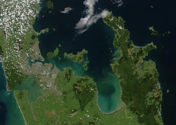
| Описание | Close-up of the area around the city of Auckland (left) and Coromandel Peninsula (right).
"This stunning true-color image provides a rare, cloud-free look at the island nation of New Zealand, including most of its North and South Islands. This scene was acquired by the Moderate Resolution Imaging Spectroradiometer (MODIS), flying aboard NASA’s Terra satellite, on October 23, 2002. New Zealand is situated in the South Pacific Ocean, roughly 2,000 km (1,250 miles) southeast of Australia. Wellington, the capital of New Zealand, is located on the southern tip of the North Island, looking across Cook Strait toward South Island." |
|---|---|
| Источник | https://lance-modis.eosdis.nasa.gov/cgi-bin/imagery/single.cgi?image=NewZealand.A2002296.2220.250m.jpg (image link); see also https://earthobservatory.nasa.gov/images/3101/new-zealand and https://visibleearth.nasa.gov/view.php?id=62892 |
| Время создания | Taken on 23 October 2002 |
| Автор или правообладатель | NASA/GSFC/MODIS Land Rapid Response Team, Jacques Descloitres — Лицензия: Public domain (в общественном достоянии) |
| Другие версии файла | — |


Источник файла — сайт Wikimedia Commons, куда он был загружен под одной из свободных лицензий ( https://commons.wikimedia.org/wiki/File:Coromandel.arp.375pix.jpg ). Авторов, работавших над этим файлом см. в истории файла: https://commons.wikimedia.org/w/index.php?title=File:Coromandel.arp.375pix.jpg&action=history


В общем случае в статьях энциклопедии Руниверсалис файлы используются в соответствии со статьёй 1274 Гражданского кодекса Российской Федерации.
История файла
Нажмите на дату/время, чтобы увидеть версию файла от того времени.
| Дата/время | Миниатюра | Размеры | Участник | Примечание | |
|---|---|---|---|---|---|
| текущий | 23:01, 3 октября 2023 | | 570 × 404 (38 КБ) | Я, робот (обсуждение | вклад) | == Описание == {{Изображение | описание = Close-up of the area around the city of Auckland (left) and Coromandel Peninsula (right). "This stunning true-color image provides a rare, cloud-free look at the island nation of New Zealand, including most of its North and South Islands. This scene was acquired by the Moderate Resolution Imaging Spectroradiometer (MODIS), flying aboard NASA’s Terra satellite, on October 23, 2002. New Zealand is situated in the South Pacific Ocean, roughly 2,000 km (... |
Вы не можете перезаписать этот файл.
Использование файла
Следующий файл является дубликатом этого файла (подробности):

- Файл:Coromandel.arp.375pix.jpg на общем хранилище
Следующая страница использует этот файл:
