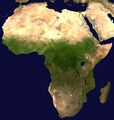
Файл:Africa satellite plane.jpg

Исходный файл (2538 × 2670 пкс, размер файла: 271 Кб, MIME-тип: image/jpeg)
Описание
| Описание | A composed satellite photograph of Africa. |
|---|---|
| Источник | The image is from [1] ("Blue Marble: Land Surface, Shallow Water, and Shaded Topography ", 2002). I took the two 21600x21600 images, land_shallow_topo_west.tif and land_shallow_topo_east.tif, and composed them. I cropped the resulting image at 8460x8900+19400+6200. Regarding the source data of the original, NASA-Blue Marble file, it is being explained [2] that it
|
| Время создания | Отсутствует информация о времени создания! |
| Автор или правообладатель | NASA — Лицензия: Public domain (в общественном достоянии) |
| Другие версии файла | — |
Источник файла — сайт Wikimedia Commons, куда он был загружен под одной из свободных лицензий ( https://commons.wikimedia.org/wiki/File:Africa_satellite_plane.jpg ). Авторов, работавших над этим файлом см. в истории файла: https://commons.wikimedia.org/w/index.php?title=File:Africa_satellite_plane.jpg&action=history
В общем случае в статьях энциклопедии Руниверсалис файлы используются в соответствии со статьёй 1274 Гражданского кодекса Российской Федерации.
История файла
Нажмите на дату/время, чтобы увидеть версию файла от того времени.
| Дата/время | Миниатюра | Размеры | Участник | Примечание | |
|---|---|---|---|---|---|
| текущий | 05:48, 10 августа 2023 |  | 2538 × 2670 (271 Кб) | Я, робот (обсуждение | вклад) | == Описание == {{Изображение | описание = A composed satellite photograph of [https://en.wikipedia.org/wiki/Africa Africa]. | источник = <p>The image is from [https://archive.org/details/VE-IMG-2433 [1]] ("Blue Marble: Land Surface, Shallow Water, and Shaded Topography ", 2002). I took the two 21600x21600 images, [http://visibleearth.nasa.gov/images/2433/land_shallow_topo_west.tif land_shallow_topo_west.tif] and [http://visibleearth.nasa.gov/images/2433/land_shallow_topo_east.tif land_shallo... |
Вы не можете перезаписать этот файл.
Использование файла
Следующие 2 страницы используют этот файл: